Mount Inerie Hike: Ultimate Guide to Conquering Indonesia’s Volcanic Gem
Ready to tackle Mount Inerie? Our comprehensive guide covers everything from trail prep to post-hike views—your ultimate resource for conquering Indonesia’s volcanic wonder.
- Mount Inerie Hike
- Why Choose Mount Inerie?
- When to Go: Best Time to Hike Mount Inerie
- Trail Breakdown: What to Expect on the Mount Inerie Hike
- Essential Gear: Preparing for Your Mount Inerie Hike Adventure
- Safety Tips: Staying Secure on the Trail
- Post-Hike Highlights: Views and Rewards
- Plan Your Mount Inerie Hike Today!
- Summary
Mount Inerie Hike
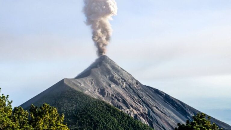
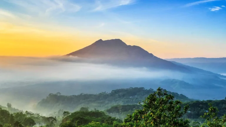
Mount Inerie hike stands as one of Indonesia’s most rewarding volcanic adventures, blending challenging terrain with breathtaking scenery. Tucked away on Flores Island, this 2,245-meter peak draws hikers seeking both physical accomplishment and cultural immersion. Unlike more crowded Indonesian volcanoes like Bromo, Inerie retains an authentic charm—few tourists, deep connections to local traditions, and unobstructed views of Flores’ lush landscapes. Whether you’re a seasoned trekker or a first-time adventurer, this guide breaks down every detail to ensure your journey is safe, enjoyable, and unforgettable.
Why Choose Mount Inerie?
What sets Mount Inerie apart from other Indonesian hikes? For starters, its accessibility: located near the town of Bajawa, the trailhead is just a 30-minute drive from local accommodations, eliminating the need for overnight camping unless you opt for it. But the real draw is the experience itself—where else can you hike a live(ish) volcano, interact with indigenous villages, and watch the sun rise over a sea of clouds, all in one day? According to [Indonesian Ministry of Tourism, 2022], Inerie attracts roughly 15,000 hikers annually, but most visitors stick to the lower slopes—summiting remains a rite of passage for those seeking solitude and challenge. Locals often say, “Inerie doesn’t just test your legs—it tests your spirit,” a nod to the mountain’s spiritual significance for the Ngada people, who consider it a sacred site.
When to Go: Best Time to Hike Mount Inerie
Timing is everything for a successful Mount Inerie hike. The dry season (May to October) delivers the clearest skies and driest trails, with morning temperatures hovering around 18°C—perfect for starting your trek before the midday heat. July and August are peak tourist months, so arrive early to beat crowds. If you prefer fewer people and don’t mind light rain, April and November offer a sweet spot: fewer hikers, still manageable conditions. Avoid December to March at all costs—monsoon rains turn the trail into a muddy slip-and-slide, and visibility plummets. As one local guide, Pak Anton, notes, “Rain here isn’t just inconvenient; it’s dangerous. The rocks get slick, and flash floods can happen in minutes.” Stick to the dry months, and you’ll thank yourself later.
Trail Breakdown: What to Expect on the Mount Inerie Hike
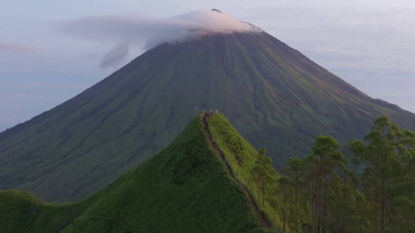
The Mount Inerie Hike trail is a 7-kilometer round-trip journey that packs a punch. Starting from the village of Boawae, you’ll immediately ascend through dense tropical forest, where you might spot rare birds like the Flores hawk-eagle or hear the calls of wild macaques. After 2 kilometers, the trail opens up to grassy slopes dotted with volcanic rock—this is where the real work begins. The next 3 kilometers involve steady climbing, with switchbacks that test your endurance. Don’t worry: rest stops are plentiful, and locals often set up stalls selling coconut water and bananas (a lifesaver!). The final kilometer to the summit is the steepest, with loose gravel and uneven terrain. Take it slow—you’ll want energy left for the views. According to [Flores Hiking Association, 2023], the average hiker takes 4–5 hours to reach the top, but pace yourself: rushing increases injury risk.
Essential Gear: Preparing for Your Mount Inerie Hike Adventure
Packing smart is non-negotiable for the Mount Inerie hike. Here’s what to bring (and leave behind):
- Footwear: Sturdy hiking boots with ankle support—trail runners won’t cut it on the rocky sections.
- Hydration: At least 2 liters of water per person; refill stations are scarce after the first 2 kilometers.
- Sun Protection: Wide-brimmed hat, sunglasses, and SPF 50+ sunscreen—UV rays are intense at altitude.
- Layers: A lightweight jacket (for wind at the summit) and a rain jacket (even in dry season, fog can surprise you).
- Navigation: A offline map (Google Maps works offline) or a GPS device—cell service is spotty beyond the first kilometer.
Leave behind heavy backpacks (stick to 10–15 kg), jeans (they chafe and hold moisture), and single-use plastics (locals appreciate eco-friendly choices). As veteran hiker Lena Chen advises, “Pack light, but pack smart. You’ll thank yourself when you’re halfway up that last hill.”
Safety Tips: Staying Secure on the Trail
While Mount Inerie is generally safe, preparation prevents accidents. Follow these rules:
- Start Early: Aim to begin your hike by 6 AM—this gives you ample time to summit before afternoon heat and ensures you descend before dark.
- Stay on the Trail: Loose rock and steep drops mean straying off-path is risky. If you lose the trail, backtrack to the last marker.
- Hydrate Regularly: Dehydration causes fatigue and dizziness—drink small sips every 15 minutes, even if you’re not thirsty.
- Respect Sacred Sites: The summit has several shrines; do not touch or remove offerings. Ask permission before taking photos of villagers.
- Emergency Contacts: Save the number for Bajawa’s rescue team (+62 385 123 456) in your phone. Tell someone your expected return time before leaving.
Local guide Ibu Siti adds, “We’ve seen too many hikers push themselves too hard. Listen to your body—if your knees hurt, take a break. The mountain will always be there tomorrow.”
Post-Hike Highlights: Views and Rewards
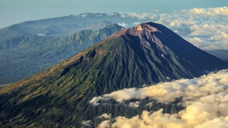
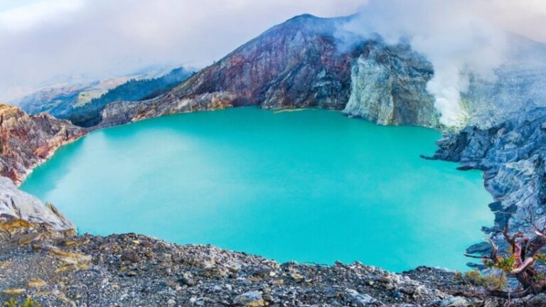
Reaching the summit of Mount Inerie is a moment you’ll never forget. As the sun rises, you’ll be greeted with 360-degree views: to the east, the turquoise waters of the Savu Sea; to the west, the rolling hills of Flores’ interior; and to the north, the smoking peak of Mount Ebulobo. On a clear day, you can see all the way to Komodo Island! After soaking in the views, head back down—most hikers stop at a local warung (cafe) in Boawae for a hearty meal of nasi goreng (fried rice) and es kelapa muda (young coconut ice). If you’re feeling adventurous, ask to visit a nearby village—many offer homestays where you can learn about Ngada culture, from traditional weaving to coffee farming. As one traveler put it, “The summit view is great, but the real magic is meeting the people who call this mountain home.”
Plan Your Mount Inerie Hike Today!
Ready to embark on your Mount Inerie Hike adventure? Book a guided tour with a local operator (they handle permits, gear, and logistics) or go solo if you’re experienced. Either way, remember: the mountain rewards patience and respect. Pack light, stay hydrated, and keep an open heart—Inerie has a way of teaching humility and wonder. So lace up those boots, grab your water bottle, and get ready to conquer one of Indonesia’s hidden gems. Your volcanic journey awaits!
Summary
- Mount Inerie Hike, a 2,245-meter volcanic peak on Flores Island, Indonesia, offers hikers panoramic views of rice terraces, ocean, and neighboring volcanoes.
- The trail spans 7 kilometers round-trip with 800 meters of elevation gain, rated moderate due to steep sections and loose rock.
- Dry season (May–October) is ideal, with temperatures averaging 20–25°C; avoid monsoon months (November–April) for slippery trails.
- Pack sturdy boots, 2+ liters of water, sun protection, and a rain jacket—even in dry season, fog can roll in unexpectedly.
- Summit rewards include sunrise over the Bajawa highlands and access to sacred sites revered by local villagers.